Supercell storms spin up multiple tornadoes in Mississippi, some back-to-back

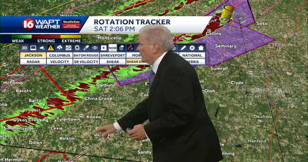
AGAIN, THIS IS A DANGEROUS STORM PRODUCING A TORNADO. THIS IS THE SAME CELL WHICH PRODUCED THE DAMAGE AND POWERFUL TORNADO THAT MOVED ACROSS OUR SOUTHERN COUNTIES, WENT THROUGH NORTHERN WALTHALL COUNTY AND THEN MOVED ACROSS JEFFERSON DAVIS COUNTY. WE DO SEE A BIT OF A DEBRIS SIGNATURE RIGHT THERE IT IS. AND THAT DEBRIS SIGNATURE IS COMING UP ON THE TAYLORSVILLE COMMUNITY RIGHT NOW. SO DANGEROUS SITUATION. CERTAINLY DEVELOPING THERE. AND LET’S CHECK THE SHEAR. THERE’S PLENTY OF SHEAR. THE SHEAR SWATH. WE GOT THESE TRACKS ALL OVER AGAIN. THIS IS THE SAME TORNADO. YOU CAN SEE ALL THE COMMUNITIES THAT HIT. THERE’S THE CELL THAT’S RIGHT BEHIND IT. THE SECOND TORNADO, BOTH OF THEM CONFIRMED ON THE GROUND. AND YOU CAN SEE HOW THE TRACK OF THAT CELL GOES ALL THE WAY DOWN INTO THE NORTHERN PARTS OF LOUISIANA. CERTAINLY A SERIOUS SITUATION. I DON’T YOU KNOW, THERE’S BEEN SO MUCH GOING ON, AND WE’RE TRYING OUR BEST. I HAVE NOT BEEN ABLE TO KEEP UP WITH THE STORM REPORTS. I KNOW WE’VE BEEN MENTIONING THEM AS FREQUENTLY AS WE COULD, BUT QUITE HONESTLY, A LOT OF TIMES WHEN YOU’RE IN A SITUATION LIKE THIS, EMERGENCY MANAGEMENT IS IN TOO MUCH OF A SITUATION WHERE THEY’RE TRYING TO TAKE CARE OF PEOPLE, THAT THE INFORMATION DOESN’T ALWAYS GET OUT AS QUICKLY AS IT CAN. COMING RIGHT OVER TAYLORSVILLE RIGHT NOW. LET’S GO OVER TO CHRISTINA. SHE’S GOT THE DEBRIS SIGNATURE UP THERE. DOESN’T LOOK GOOD. >> NO. >> NOT AT ALL. LET ME JUST BEFORE WE. YEAH. LET ME GO TO THE SEVERE. I’M CONCERNED THAT THE WINDS HAVE SLIGHTLY. YEAH. LOOK AT THIS. WE’RE UP TO 100 MILES AN HOUR AGAIN. >> I’M NOT SHOCKED. >> COULD BE F3 AGAIN. SO WE SAW IT. F3, F4 WEAKENED A LITTLE BIT. IT’S STRONG AGAIN. >> AND THIS IS THE SAME EXACT CELL THAT
Supercell storms spin up multiple tornadoes in Mississippi, some back-to-back
Updated: 6:00 PM CDT Mar 15, 2025
A storm system produced multiple tornadoes, including a rare tornado emergency Saturday in Mississippi.Radar | Weather Alerts | Download the WAPT App Around 12:30 p.m., a confirmed tornado was reported in southern Pike County and moved into Walthall County with winds up to 100 mph. Trees were snapped, along with power lines, leaving hundreds in the dark. The tornado moved into the Salem area just before 1 p.m. WAPT Chief Meteorologist said catastrophic damage was possible from what looked to be at least an EF3 tornado. A second tornado moved into Walthall County at about 1:35 p.m. That tornado did not appear to be as strong as the first one, but it followed the same track as the first tornado, according to the 16 WAPT Weather Team.Another cell produced a tornado around 1:40 p.m. in Smith County, moving into Covington County. Just as with Walthall County, a second tornado moved into Smith County about 30 minutes later, headed toward Taylorsville.Earlier in the day, a tornado was confirmed around 10:30 a.m. in Humphreys County. It continued east across the Delta counties, with confirmed damage in Issaquena County near Grace. Some houses damaged and power lines were down. Injuries were reported in the Grace area. In Washington County, a farm shop was destroyed. The storm system is huge, affecting portions of several states, including Louisiana and Alabama.
JACKSON, Miss. —A storm system produced multiple tornadoes, including a rare tornado emergency Saturday in Mississippi.
Radar | Weather Alerts | Download the WAPT App
Around 12:30 p.m., a confirmed tornado was reported in southern Pike County and moved into Walthall County with winds up to 100 mph. Trees were snapped, along with power lines, leaving hundreds in the dark.
The tornado moved into the Salem area just before 1 p.m. WAPT Chief Meteorologist said catastrophic damage was possible from what looked to be at least an EF3 tornado.
A second tornado moved into Walthall County at about 1:35 p.m. That tornado did not appear to be as strong as the first one, but it followed the same track as the first tornado, according to the 16 WAPT Weather Team.

Another cell produced a tornado around 1:40 p.m. in Smith County, moving into Covington County. Just as with Walthall County, a second tornado moved into Smith County about 30 minutes later, headed toward Taylorsville.
Earlier in the day, a tornado was confirmed around 10:30 a.m. in Humphreys County. It continued east across the Delta counties, with confirmed damage in Issaquena County near Grace. Some houses damaged and power lines were down. Injuries were reported in the Grace area.
In Washington County, a farm shop was destroyed.
The storm system is huge, affecting portions of several states, including Louisiana and Alabama.