MERIDIAN, Miss. (WTOK) – With a cold front approaching overnight, we have the potential for some severe weather into early Monday morning. Keep your weather guard up heading into this evening and have multiple ways of getting alerts.
FIRST ALERT WEATHER DAY: SUNDAY PM – MONDAY AM
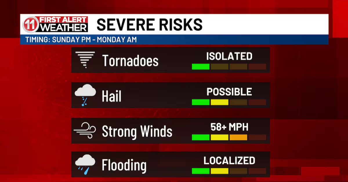
We’re still monitoring a cold front that is expected to bring the potential for severe weather into our area over Sunday night and into early Monday morning. The Storm Prediction Center has put most of our area under an Enhanced (3/5) Risk for severe weather heading into the overnight hours of Sunday and into Monday morning. While all threats remain on the table, the most prominent threats are the potential for high winds and damaging hail, as well as a risk for localized flooding. This line is expected to move through between 12am and 8am for most of our area. Make sure you have multiple ways of getting weather alerts, as this is an overnight/early morning event.

The Storm Prediction Center has put most of our area under an Enhanced (3/5) Risk for severe weather heading into the overnight hours of Sunday and into Monday morning.(WTOK)
Behind this line, things get better for a while. Showers and storms clear out for a pleasant partly cloudy Monday afternoon with highs in the mid and upper 70s. Tuesday brings mostly sunny skies and a return to the upper 70s and lower 80s.
We will see more rain chances returning in the midweek, as Wednesday and Thursday bring partly to mostly cloudy skies, a chance for scattered showers and storms, and winds with gusts upwards of 35mph as another system makes its way through. Temperatures will also be very warm, with highs in the mid and potentially even the upper 80s.
Copyright 2025 WTOK. All rights reserved.