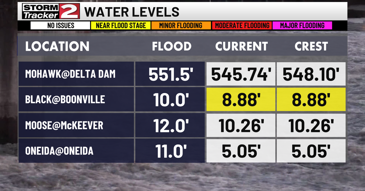
A flood watch remains in effect until 8pm Monday evening. Local waterways are running high this morning after ample snowmelt and heavy rainfall Sunday. Fish Creek and West Canada Creek have experienced flooding.


Dry but colder Monday with highs in the low 40s. Warming trend returns again as highs are in the mid 50s Tuesday, mid 60s on Wednesday with abundant sunshine. A few light showers Thursday, with highs in the upper 50s to begin Spring.

It cools down substantially ahead of Friday, as highs will only be in the upper 30s. Lows Thursday night will dip into the 20s, and we will have areas of patchy black ice Friday morning. Fortunately, yet again, the colder weather does not last, and we are back to the 50s with partly sunny skies Saturday.