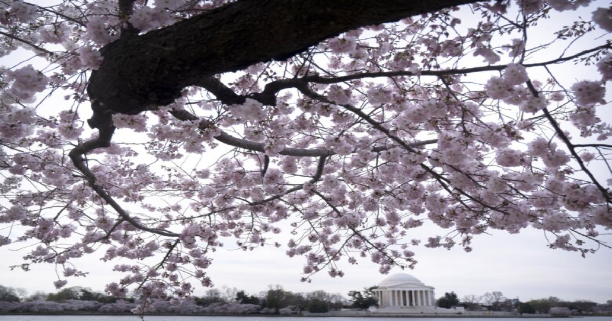
If you’ve been waiting for the perfect day to see the cherry blossoms in peak bloom, look no further. Saturday is looking like it’s going to be the warmest day of the year so far.
It may be time to lock up those layers! Despite seeing some gloomy clouds that will loom over the D.C. region, residents see some unseasonably warm temperatures that will climb into the low to mid 80s by the afternoon.
Make sure to be careful, though, as the National Weather Service has issued a Red Flag Warning for the D.C.-area until 7 p.m., alerting to an increased fire risk for the region. The NWS does not recommend open burning on Saturday.
On top of the local fire warning, southwesterly winds have the potential to draft some smoke over the mountains into our area due to wildfires in North Carolina and South Carolina. You may be able to see and smell the smoke, according to 7News First Alert Meteorologist Eileen Whelan.
On the bright side, Whelan added that the winds will create the perfect climate for the Cherry Blossom Kite Festival on Saturday by the Washington Monument.
Traffic woes
Beware: Expect backups all around the National Mall and the Tidal Basin, as people continue to pile in to see the cherry blossoms. WTOP’s Traffic Center has reported backup in Southwest D.C, from Independence Ave to Maine Ave and 17th Street. On Interstate 395, residents can also expected to be affected.
Also adding to traffic woes, the Nationals. The D.C. team are set to host the Phillies for a 4 p.m. game.
Looking ahead
Don’t worry, these warm temperatures aren’t fleeting. Sunday you can expect another cloudy but warm day, with highs in the upper 70s.
Come Monday, we will likely see some storms rumble into our region.
You can check out the full forecast below.
FORECAST
SATURDAY: Mostly cloudy, very warm
Highs: 80-85
Winds: Southwest 5-15 mph
Today will likely be the warmest day of the year, so far, with afternoon highs soaring into the low to mid 80s. The record high is 92 set back in 1907. Keep in mind our average daytime high is 61 degrees, so we’ll be a good 20 degrees above normal. Southwesterly winds will be perfect for the Cherry Blossom Kite Festival today, but it may also lead to smoke from wildfires in SC/NC riding up along the mountains before dissipating over the metros. Concentration may be high enough that visibility and smell may be affected.
SATURDAY NIGHT: Mostly cloudy, mild
Lows: 60s
Winds: Southwest 5-10 mph
Saturday evening and night will feature very mild temperatures this time of year with lows inside the beltway hovering just around 60 degrees.
SUNDAY: Mostly cloudy; Isolated showers
Highs: Around 80
Winds: South 5-15, Gusts 25 mph
Clouds will win the day, but it will remain very warm for late March with highs in the upper 70s. Our average high for this time of year is 60 degrees, so well above normal. There’s a slight chance for a few passing showers during the afternoon and evening; however; many will stay rain-free.
MONDAY: STORM ALERT Partly to mostly cloudy, windy; Showers and storms likely
Highs: 70s
Winds: Southwest 10-20, Gusts to 30 mph
First Alert Weather continues to monitor the risk for showers and strong thunderstorms Monday, all part of a cold front that will bring a push of cooler air for Tuesday.CURRENT CONDITIONS
Get breaking news and daily headlines delivered to your email inbox by signing up here.
© 2025 WTOP. All Rights Reserved. This website is not intended for users located within the European Economic Area.