by Storm Alert Weather Team
Sun, March 30th 2025 at 7:59 AM
Updated Sun, March 30th 2025 at 9:53 AM
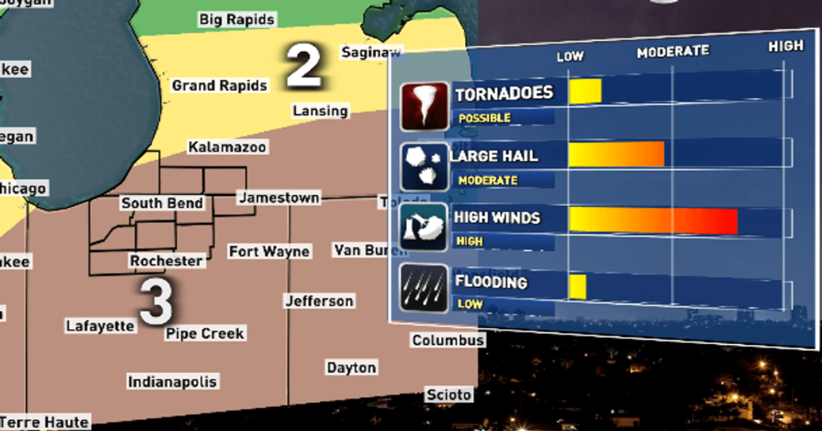
Virtually all of Michiana has been placed under a level 3 risk for severe weather Sunday (WSBT 22)
Strong to severe storms will roll through Michiana late Sunday.
The Storm Prediction Center has placed most of our area under a level 3 risk for severe weather.
Sunday starts off dry, but a strong cold front will eventually push into the area as we approach the evening and bring chances for storms.
The front will likely start to enter around 3-4 PM and will take a decent chunk of the evening to exit. Most forecast models have rain wrapping up by 9 PM.
Some storms could be on the strong to severe side. Our main concerns remain for damaging winds and hail.
Winds are expected to reach 50-60 mph, with even stronger gusts. Hail of 1″ in diameter is also likely, and some isolated spots could see hail stones larger than that.
An isolated tornado cannot be ruled out, however the threat is a lot lower than that for hail and wind.
After the front passes, much colder air will rush in. Temperatures Sunday night will fall to the mid-30s, and we will only reach the upper 30s to around 40 on Monday.
Outside a few lingering showers Monday, we will get a break from the rain for a few days.
Highs will climb back to a more spring-like feel by mid-week. We will return to the mid-60s Wednesday, but it comes with another chance for showers and storms.